海金刚海岸公路,经典蓝调的诱惑 in 庆尚南道 巨济市 · schedule 当天 · distance 10.4km · 5 stops · highlights 학동동백숲, Hammok Mongdol Beach, Sinsundae

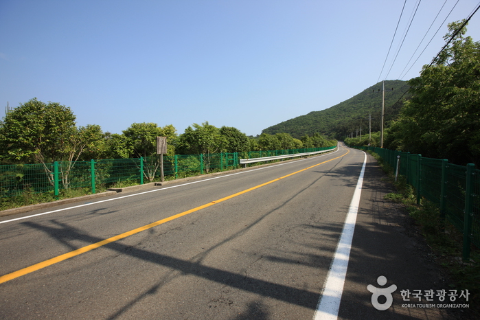
沿海岸公路行驶的自驾游景点是非接触式旅行的精华。可以遇见由山、田、海、天空和岩石构成的各种自然景观。无论季节如何,都可以旅行。南部有许多令人向往的海岸公路。特别是翡翠色的海水、亿万年时间和海浪形成的奇岩怪石、层层叠叠的岩层,以及沙沙作响的鹅卵石海滩合唱声。所有这些景观都集中在巨济岛海金刚海岸公路。这里既像南太平洋的小岛,也有希腊圣托里尼般的异国风情。
这条路线是单日行程示例。你可以直接保存,或扩展为 AI 行程。
동부면 학동리 해안 기슭에 자생하는 동백숲은 전국 최대의 규모이다. 천연기념물 제233호로 지정, 보호되고 있다. 2월 말에서 3월초에는 붉게 타오르는 동백의 화려한 모습을 감상할 수 있다. 학동 동백숲은 아름다운 길로 지정된 국도 14호선을 타고 학동 삼거리에서 함목 삼거리까지 5.4km까지 이어진다.
Located at the entrance of Haegeumgang on Geoje Island, this pebble beach features pebbles of various colors and shapes harmonizing with clear blue seawater. Hammok Mongdol Beach is a modest-sized beach, 200m long and 30m wide, accommodating about 400 bathers. The beach and its surrounding area are designated as part of Hallyeohaesang National Marine Park, offering scenic natural attractions such as Sinseondae, Wind Valley, and a camellia tree walking trail. Nearby tourist spots include Garasan Bongsudae, Myeongsa Beach, Dadae Mountain Fortress, and Haegeumgang, attracting visitors year-round.
Sinsundae is a large rock located by the sea in Dojangpo Village, Galgot-ri, Nambu-myeon, Geoje-si. It is called Sinsundae because it is said to be a place where immortals played. Sinsundae is a place with beautiful scenery including the surrounding coastal views and is also called Gatbawi (Hat Rock) due to its hat-like shape. There is a folk belief that if a person seeking a government position offers a ritual at this rock, their wish will come true. From the rock, you can see the far-reaching Dadohae scenery. Next to the rock is Hammok Beach, a small beach with pebbles, and on the hill of Dojangpo Village, there is the Sinsundae Observatory where visitors can enjoy an open view of the sea. The observatory is located on the right side of the road to Haegeumgang and is easily accessible by car.
If you go down to the left on the way to Haegeumgang, you will come to Dojangpo Village, and the place located north of that village is the Hill of the Wind. The original name was 'Ddibatneul,' but since 2002 it has been called the Hill of the Wind. Looking at the sea from the hill, it is infinitely wide, quiet, and the cool breeze brings freshness. Everything seen here wears a leisurely charm that is never boring. The island, the lighthouse, the cruise ship, and even the wind all look leisurely. It is the perfect place to throw away or let your burdens be carried away by the sea or the wind. In November 2009, a windmill was installed to provide a sightseeing attraction for tourists. (Source: Geoje Culture and Tourism Homepage)
It is a rocky island located about 500 meters south of Galgae Village, Galgot-ri, Nambu-myeon, Geoje-si (approximately 116m above sea level, area about 0.1㎢). Haegumgang, formed by two connected islands, belongs to Hallyeohaesang National Park and was designated as a scenic site in 1971. It is widely called Haegumgang, meaning the Geumgang Mountain of the sea, rather than its original name Galdo (Kichul Island), because its shape resembles the spreading roots of Kichul (arrowroot). This island, about 116m above sea level and 0.1㎢ in area, is also called Herb Island due to the abundance of medicinal herbs, and it is said that Seo Bul and his 3,000 followers seeking the elixir of longevity visited, with the inscription 'Seobulgwacha' carved there. The surrounding scenery includes many unique rock formations such as the dozen-armed sea cave, which is Haegumgang's most beautiful sight, Lion Rock, Buddha Rock, and Candle Rock. Additionally, there is Ilwolbong, famous for its spectacular sunrise and moonrise. Sightseeing boats operate around the Haegumgang islands from locations within Geoje-si, such as Haegumgang, Dojangpo, Hakdong, Gujora, and Wahyeon.
优先展示路线结束后方便休息的住宿
注册成为会员,让更多人认识你的频道。
(成为会员后,在“我的页面”中设置 Instagram、YouTube、博客链接,我们会在你发表的每条评论旁一起展示。)
““住在弘大附近,晚上去了一圈咖啡馆,城市夜景和氛围都太完美了。””
以访客身份发表的评论,不会显示任何社交账号链接或个人资料卡片
分享一条关于这个地点的小贴士吧。
或者以访客身份快速留下一个评论。
请登录后再上传照片。
还没有任何评论,快来写下你的第一条感受吧!