延川で出会う高句麗 in 京畿道 延川郡 · schedule その他 · distance 51.9km · 3 stops · highlights Godaesan, Dangposeong Fortress, Yeoncheon Horogoru
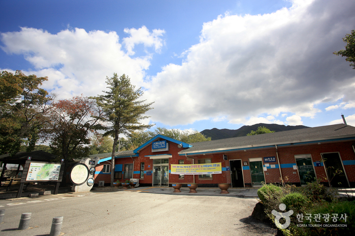
新炭里駅は白馬高駅が開放される前まで京元線の鉄道終点であった場所です。新炭里駅周辺には「統一を願う村」に関連する多様な見どころがあり、古代山を訪れる人が多いです。延川の虎牢古墳、銀垈里城、唐浦城は韓国南部では珍しい高句麗の遺跡です。漢江まで領有していた高句麗が臨津江まで後退して築いた防御線です。2000年代に発掘され、これら三つの遺跡はいまだに馴染みの薄い旅行地です。
このコースは1日旅程のサンプルです。そのまま保存するか、AI日程に拡張できます。
Godaesan (832m) is a mountain located on the border between Yeoncheon-gun, Gyeonggi-do, and Cheorwon-gun, Gangwon Special Self-Governing Province. Among mountains open for hiking, it is the closest to North Korea. From Godaebong, the summit of Godaesan, you can see the Cheorwon plain, Baengmagoji—a fierce battlefield during the Korean War—as well as North Korea’s Geumhak-san, Jijangbong, Bukdaesan, and Hyangrobong. Traditionally, Godaesan is considered one of Korea’s three sacred mountains (Samsinsan) associated with the legendary prophetic names Johwasin, Gyohwasin, and Chihwasin. The name Godaesan is also said to originate from “big whale,” linked to a new place name, referring to “banggorae” (a groove under the ondol heated floor where fire and smoke escape). Because Godaesan has deep valleys and is tall, it was named thus. Old maps also recorded it as Godae, meaning “like a high constellation.” The area around Godaesan was formerly known as Sintanmak, named for many taverns (jumak) established in villages amid abundant dense forests and rich forest resources suitable for producing timber and charcoal. Before the Korean War, the region was widely known for producing high-quality charcoal.
Dangposeong Fortress maximized the use of terrain, building stone fortress walls only on the east side, connected by flat land without vertical cliffs. The east fortress wall is about 50m long and remains approximately 6m high, with a length of about 200m from the east wall to the west end of the fortress, and an overall circumference of about 450m. Most stones used for construction were processed local basalt, a major characteristic of Goguryeo fortresses. Behind Dangposeong Fortress lies Majeonhyeon, a route to Gaeseong, making the fortress essential for defending against northern enemies approaching the Yangju basin area by the shortest route. It also held a very important position for defending against southern enemies, indicating it was used continuously even during the Silla occupation period.
Horogoru is located at an important gateway connecting Gaeseong and Seoul, built on a basalt cliff formed by a tributary flowing from Wondang-ri into the Imjin River. There are two theories about the origin of the name Horogoru: one says it is named because the nearby terrain resembles a gourd or bottle gourd, and another that it combines 'hol' meaning town and 'goru' meaning fortress. Among Goguryeo defense sites investigated in the Gyeonggi-do area, it is one of the three major flatland fortresses along with Dangposeong and Eundaeriseong. The east wall of Horogoru blocks the eastern part of the basalt plateau, with the highest point reaching 10 meters, offering views of the surrounding area and scenic Imjin River from atop the fortress wall. The first excavation of Horogoru was conducted from November 2000 to May 2002, confirming construction methods and structure of the fortress walls. The total perimeter of Horogoru fortress walls is 401 meters: south wall 161.9m, north wall 146m, east wall 93.1m, covering an internal area of 606㎡ on a roughly 28-meter-high basalt cliff. The east wall shows a construction technique that combines the advantages of stone and earth fortresses by layering packed earth multiple times and raising stone walls on top.
コース後に休みやすい宿を集めました
会員登録して自分のチャンネルも一緒に紹介してもらう
(会員になると、マイページで設定した Instagram・YouTube・ブログのリンクが、あなたのコメントと一緒に表示されます。)
“「弘大近くに滞在して、夜のカフェ巡りをしました。街の夜景も雰囲気も最高でした。」”
ゲストとして投稿したコメントには、SNSリンクやプロフィールカードは表示されません。
この場所についてのちょっとしたコツや感想をシェアしてください。
ゲストとして、気軽にひとことコメントを残すこともできます。
写真の添付はログイン後に利用できます。
まだレビューがありません。最初の感想を投稿してみましょう!


