北を望む延川の歴史一日コース in 京畿道 延川郡 · schedule その他 · distance 92.3km · 6 stops · highlights Yeolsoe Observatory, 태풍전망대, 점심식사(하남식당)
北側の土地が見える延川の一日コースです。山の地形が深く、開発が遅れている延川のかなり長いコースですが、飾り気のない自然をそのまま体験できる珍しいコースです。深い谷を中心に古代山と呼ばれる山があり、展望台や日帝強占期から現在まで残る給水塔、そして全谷里遺跡まで歴史の痕跡を見渡せます。
このコースは1日旅程のサンプルです。そのまま保存するか、AI日程に拡張できます。
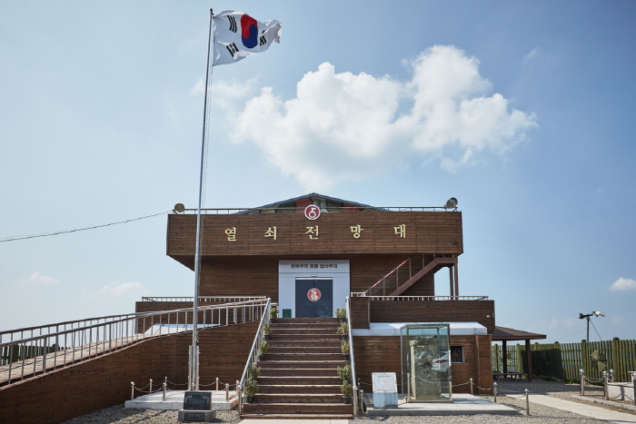
Yeolsoe Observatory was established on April 11, 1998, by the Army Yeolsoe Unit to provide security education and soothe the grievances of displaced persons. From the observatory, visitors can see the DMZ barbed wire fence and the frontline guard post (GP) at a glance. Inside the exhibition hall, North Korean household items and combat equipment against South Korea are displayed, offering a fragmented glimpse of North Korea's actual conditions. The exhibition hall also features a unification wish postcard tree shaped with barbed wire, adding interest for visitors.
천하무적 태풍부대에서 1991년 12월 3일 건립한 것으로, 서울에서 약 65km, 평양에서 약 140km 떨어진 중면 비끼산의 가장 높은 수리봉에 위치한다. 처음에는 군사분계선을 기점으로 2km 지점에 남방 한계선과 북방 한계선이 설정되었으나, 1968년 북한이 휴전선 가까이 철책을 설치함에 따라 우리나라도 1978년에 부분적으로 철책을 설치하였다. 태풍전망대는 휴전선까지 800m, 북한 초소까지는 1,600m의 거리에 떨어져 위치하고 155마일 휴전선상 북한과 가장 가까운 전망대로 유명하다.
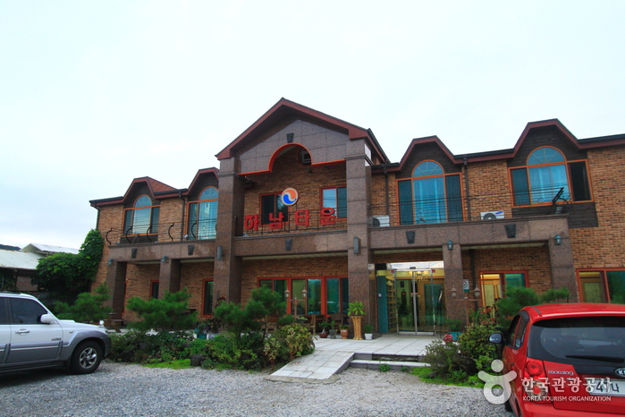
한탄강 국민관광단지내 가장 규모가 크고 민물매운탕 맛이 뛰어나기로 소문난 곳이다.
The Yeoncheon Station Water Tower is a railway water tower built in 1919 at a midpoint between Incheon and Wonsan, used to supply water to steam locomotives. Steam locomotives and water towers first appeared with the opening of the Gyeongin Line between Seoul and Incheon in September 1899, serving as transportation means but disappeared with the advent of diesel locomotives in the 1950s. All historical facilities built in Yeoncheon during the Japanese colonial period were destroyed by bombing during the Korean War, but only the water tower remains well preserved in its original form. At the time of construction, during the water supply to the tender (炭水車) attached behind the locomotive, active trade took place, functioning somewhat like a marketplace. Until before the Korean War, this area was the southernmost region of North Korea, and a large amount of North Korean military supplies were unloaded via the Gyeongwon Line. Because of this, the white water tower served as a coordinate for intense air raids by U.S. forces, and shell marks are still clearly visible on the building. The Yeoncheon Station Water Tower, along with the water towers at Dogye Station in Gangwon-do, Chupungnyeong Station, Yeonsan Station in Chungnam, Andong Station in Gyeongbuk, Yeongcheon Station, and Samrangjin Station in Gyeongnam, is recognized as a significant heritage for understanding railway history and modern transportation research, designated as a national registered cultural heritage.
Jaein Waterfall has long been widely known as a scenic spot. The waterfall is formed where a small stream flowing down from Jijangbong in the north pours down an approximately 18m high basalt columnar joint cliff, creating a spectacular sight. Around Jaein Waterfall, it is also known as a habitat for natural monuments such as Eoreumchi and endangered species like the pink dragonfly. A beautiful love story related to the name of the waterfall has been passed down. Various basalt features can be observed at Jaein Waterfall, notably columnar joints, undercut caves, potholes, and gas tubes. The waterfall, about 18m high, continues to erode the area below it, forming a pothole with a depth of 5m. A pothole is a deep hole formed when whirlpools occur in concave or broken parts of river rocks.
The Jeongok-ri Site is located around the Hantan River in Jeongok-ri, Jeongok-eup, Yeoncheon-gun, and is a representative site of the early Paleolithic period in Korea. This site, a symbol of Korea's Paleolithic heritage, gained attention in 1977 when a U.S. soldier visiting the Hantan River recreational area discovered stone tools on the surface. The Jeongok-ri stratigraphy provides very important data for studying paleoclimate and paleoenvironment and is a geological landmark with records related to human development. In the clay layer, a soil wedge structure called soil wedge cracking phenomenon is observed, presumed to have formed in the Ice Age, and is an important resource for paleoclimate research. Additionally, volcanic ash (Tephra) carried by the wind from Japan was found in the stratigraphy, revealing that the upper layers were deposited about 20,000 to 100,000 years ago. Thus, the Jeongok-ri stratigraphy is archaeologically significant and is a crucial geological site for studying paleoclimate. (Source: Hantan River Geopark website)
コース後に休みやすい宿を集めました
会員登録して自分のチャンネルも一緒に紹介してもらう
(会員になると、マイページで設定した Instagram・YouTube・ブログのリンクが、あなたのコメントと一緒に表示されます。)
“「弘大近くに滞在して、夜のカフェ巡りをしました。街の夜景も雰囲気も最高でした。」”
ゲストとして投稿したコメントには、SNSリンクやプロフィールカードは表示されません。
この場所についてのちょっとしたコツや感想をシェアしてください。
ゲストとして、気軽にひとことコメントを残すこともできます。
写真の添付はログイン後に利用できます。
まだレビューがありません。最初の感想を投稿してみましょう!